
Simi Valley ZIP Code Coverage
The geographic core of the Simi Valley ZIP code directory is split between eastern and central or western delivery areas. Two additional codes appear as Simi Valley mailing designations, but they are not ordinary neighborhood polygons. USPS should decide the delivery code for a particular address, especially when a PO box, unique recipient, institution, unit, or edge location is involved.
| ZIP | Areas Covered | Post Office | Notes |
|---|---|---|---|
| 93062 | Eastern Simi Valley, including eastern residential areas toward Santa Susana and Knolls | Simi Valley delivery | Geographic ZIP and Census ZCTA; validate each address |
| 93063 | Central and western Simi Valley, with many civic and business addresses | Simi Valley delivery | Geographic ZIP and Census ZCTA; city status still needs a GIS check |
| 93094 | Simi Valley mailing designation | Simi Valley mailing use | PO-box or specialized use only after USPS validation |
| 93099 | Simi Valley unique or specialized mailing designation | Simi Valley mailing use | Not a neighborhood area; confirm the recipient format |
These rows describe functions, not a list of everyone receiving mail. The research does not support a named station boundary or a local ZIP realignment year. The 93094 and 93099 entries belong after USPS validates the specific recipient. They should not be used to create a ZIP-wide resident count.
Simi Valley 93062 Eastern Core
Use 93062 as an eastern Simi Valley delivery area and as a Census ZCTA, not as proof that every address is inside the incorporated city. An exact street lookup comes first. USPS returns the delivery form, including the proper suffix, direction, unit, and ZIP. Ventura County GIS then shows the parcel and the Cities layer can test incorporation. The APN becomes the stable key for assessor, recorder, and permit research when a postal line changes.
Eastern areas toward Santa Susana and Knolls can carry local labels that do not match a postal polygon. A ZIP result answers “where should mail go?” It does not answer “which city department holds the permit?” or “who occupied the parcel?” Record the USPS response, GIS situs, city layer result, APN, and retrieval date as separate facts.
Simi Valley 93063 Central West
93063 covers much of central and western Simi Valley and includes many civic and business addresses. City Hall at 2929 Tapo Canyon Road uses 93063, but that single civic address is only an example. It does not define the full postal area or show that every 93063 address is inside the city line. Use the same three-way test: USPS for delivery, GIS for jurisdiction, and the relevant custodian for the record.
For a parcel tied to 93063, compare the combined and split situs fields in the county layer. Then note the APN, tract, map, book, page, block, and parcel values before asking for a deed or permit. A business address can be a useful affiliation clue, yet it is not a household list. ZIP code directory work stays accurate when each result is labeled as mail, geography, parcel, or person evidence.
Simi Valley 93094 And 93099
93094 and 93099 should be treated as PO-box, unique, or specialized mailing designations only after USPS validates the particular recipient. They are not ordinary neighborhood polygons and cannot support the same “residents by ZIP code” claim as the geographic 93062 and 93063 areas. A unique code may identify a delivery function or recipient type, while a PO-box code points to a box rather than a street parcel.
Do not infer a street boundary, city block, or named household from either code. If a record carries 93094 or 93099, preserve the full mailing line, ask USPS to validate the address mode, and use a legal description or APN for land research. If the source is an organization filing, keep its entity address separate from a person's residence.
Simi Valley ZIP Code Boundaries
USPS ZIP geography, Census ZCTA geography, and the Simi Valley city boundary answer different questions. USPS controls delivery standards. A ZCTA is a Census approximation built for aggregate population and demographic statistics. The city line is a legal jurisdiction tested through the county GIS Cities layer, annexation files, and the responsible planning or engineering office. A mailing city can appear outside the incorporated line, and a city address can carry a neighboring postal name.
- ZIP code
- A USPS delivery construct used to route mail; it is not a neighborhood or legal boundary.
- ZIP+4
- The four-digit extension that narrows a delivery route or point beyond the five-digit ZIP.
- PO-box ZIP
- A code used for box delivery rather than a normal street-delivery area.
- Unique ZIP
- A specialized code assigned to a particular organization, facility, or delivery function.
- Carrier route
- A postal delivery path inside a ZIP, not a public list of the people served.
93065 is not included in the Simi Valley directory because the research associates it with Moorpark. Proximity is not a reason to move a neighboring ZIP into a Simi Valley coverage table.
Finding Residents By ZIP Code
A lawful ZIP code directory search narrows geography before it asks a record custodian for person-linked information. The USPS city and state lookup can validate a city, state, or full-address mode. Once a ZIP narrows the area, the Simi Valley street directory handles the street-level work rather than pretending that a ZIP is a resident index.
The portal audit shows which channels can and cannot take a ZIP field:
| Portal | ZIP field? | Meaning of a ZIP query |
|---|---|---|
| USPS city or address lookup | Yes | Delivery validation for a city, state, or address |
| Census data | ZCTA selection | Aggregate population and demographic context, no named residents |
| Ventura parcel layer | No published ZIP field | Use geometry, situs, and APN; it cannot directly produce all parcels in a ZIP |
| California voter status | No public ZIP browse | Individual verification only |
| Qualified voter extract | Address fields include ZIP | Authorized analysis only, with protected records excluded |
The USPS ZIP lookup screen illustrates why the complete address must be normalized before any record search.
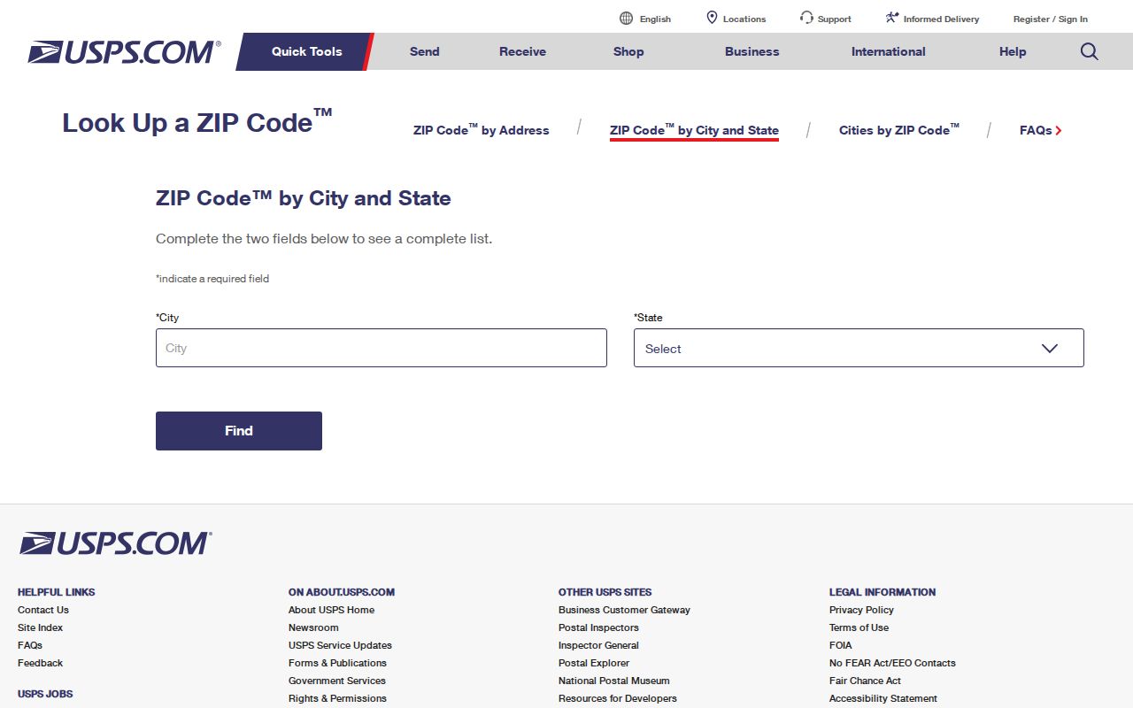
USPS confirms delivery syntax. It does not supply a public list of the residents at that delivery point.
- Enter the complete street, city, and state in USPS and save the standardized address and ZIP response.
- Open the parcel in Ventura GIS, turn on the Cities layer, and record situs, APN, and the jurisdiction result.
- Use the assessor, recorder, permit, or business custodian that matches the question, not a ZIP-wide name guess.
- Use a voter-file extract only with a certified permitted purpose. The public status tool is not a street or ZIP browse.
Simi Valley APN Address Normalization
Three address forms should be kept side by side: USPS mailing address, GIS situs address, and the deed's legal description. The county parcel service splits situs into number, direction, street, and type and also provides a combined SITUS value. Its APN, tract, map, book, page, block, and parcel fields can survive a postal change better than a ZIP string. A parcel may split, merge, gain a unit, or move from a parent tract, so retain the older APN or map reference when tracing a person or event.
The assessor and recorder have different custody roles. GIS offers map geometry and document clues. The Assessor handles property characteristics and restricted assessment information. The Recorder controls recorded deeds and legal descriptions. If the public web layer lacks a ZIP field or owner name, use the APN to request an existing parcel record, roll extract, deed index entry, or document image through the proper office. A ZIP can locate a delivery route; it cannot replace the legal land key.
Simi Valley Voter File Limits
The voter-status lookup returns an individual match to the voter who supplies identifying data. It is not a public ZIP code directory. A qualified voter-file recipient may group address fields by ZIP for an approved election, scholarly, journalistic, political, or governmental purpose, but confidential voters and Safe at Home participants receive added protection. Participation history records that a ballot was cast, never whom a voter supported.
The Secretary of State voter-file request costs $100 statewide, or $30 per named voter for up to ten names with a $100 maximum. Ventura County products and current fees can differ from older forms. The county elections office is the place to confirm a permitted local file or precinct product. Written applications preserve the purpose certification, and historical registers or poll books require a separate archive or elections-office inquiry. No public tool turns 93062 or 93063 into a named-person browse.
The official county elections directory identifies the Ventura election office used for permitted file questions.
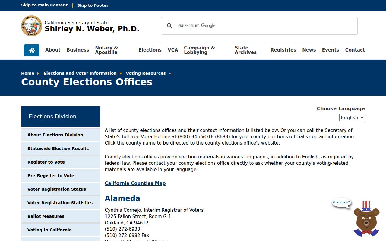
The elections-office route confirms the custodian and purpose rules. It does not make a ZIP-based resident roster public.
Simi Valley Postal Change Clues
Postal geography is temporal. ZIP codes began nationally in 1963, while older directories, deeds, and letters use city names, rural routes, boxes, or zone numbers. When tracing an older address, copy the code printed in the source instead of rewriting it with today's ZIP. Use the APN predecessor, tract, lot, block, book, and page to bridge a postal change. No official local realignment year was found, so a specific split or cutoff should not be invented.
Subdivision recording, parcel splits, unit creation, and annexation also change the right custodian. City Planning and Engineering and county GIS maintain address, sub-address, land, and planning data. The City Clerk holds annexation deeds and agreements. A focused request through the Simi Valley public-records request route can ask for an existing address-point layer, data dictionary, permit index, or renaming resolution. Under the California Public Records Act, an agency normally makes a determination within ten days, with a limited fourteen-day extension, but it need not create a custom crosswalk or reconstruct a house history.
Use the city or county office for the jurisdiction at the date of the event. A current Simi Valley label does not move an older county record into a city file, and a postal label alone does not prove incorporation.
Simi Valley ZIP Context In 2025
The Census Bureau's 2025 context is useful only as a modest geography interest layer. Simi Valley's July 1, 2025 population estimate is 124,861 across 41.55 square miles, while the 2020 census counted 126,356. The estimate is a city statistic, not a count of people in 93062, 93063, 93094, or 93099. A ZCTA statistic is also an approximation for reporting and cannot be turned into a named resident list.
Census QuickFacts for Simi Valley provides the aggregate context. For a person, return to USPS, GIS, APN, and the lawful custodian. For a parcel, retain the legal description. For a historic question, preserve the period ZIP or route. Keeping those labels apart is what makes a Simi Valley ZIP code directory useful without overstating what postal geography can prove.